I like to ride my bicycle - for long distances. I have earned the California Triple Crown and finished the Furnace Creek 508. My goals include qualifying for RAAM and ...(read the blog to find out).
"The bicycle has a soul. If you are able to love it as it deserves, it will give you emotions you will never forget."
Mario Cipolini
"Nothing compares to the simple pleasure of a bike ride."
John F. Kennedy
"The important decisions in my life I make while out riding my bike."
Former Italian Prime Minister Romano Prodi
"Pain is temporary, quitting lasts forever.” Lance Armstrong
Saturday, January 31, 2009
Amity Hill's Ride Report
It was clear when I woke up, a clear blue sky which excited me. "Perhaps I'll ride the Colnago."
I only take my Colnago out with the sky is blue, the roads are dry and there is no chance of rain. This is not my rain bike. It is my dry bike.
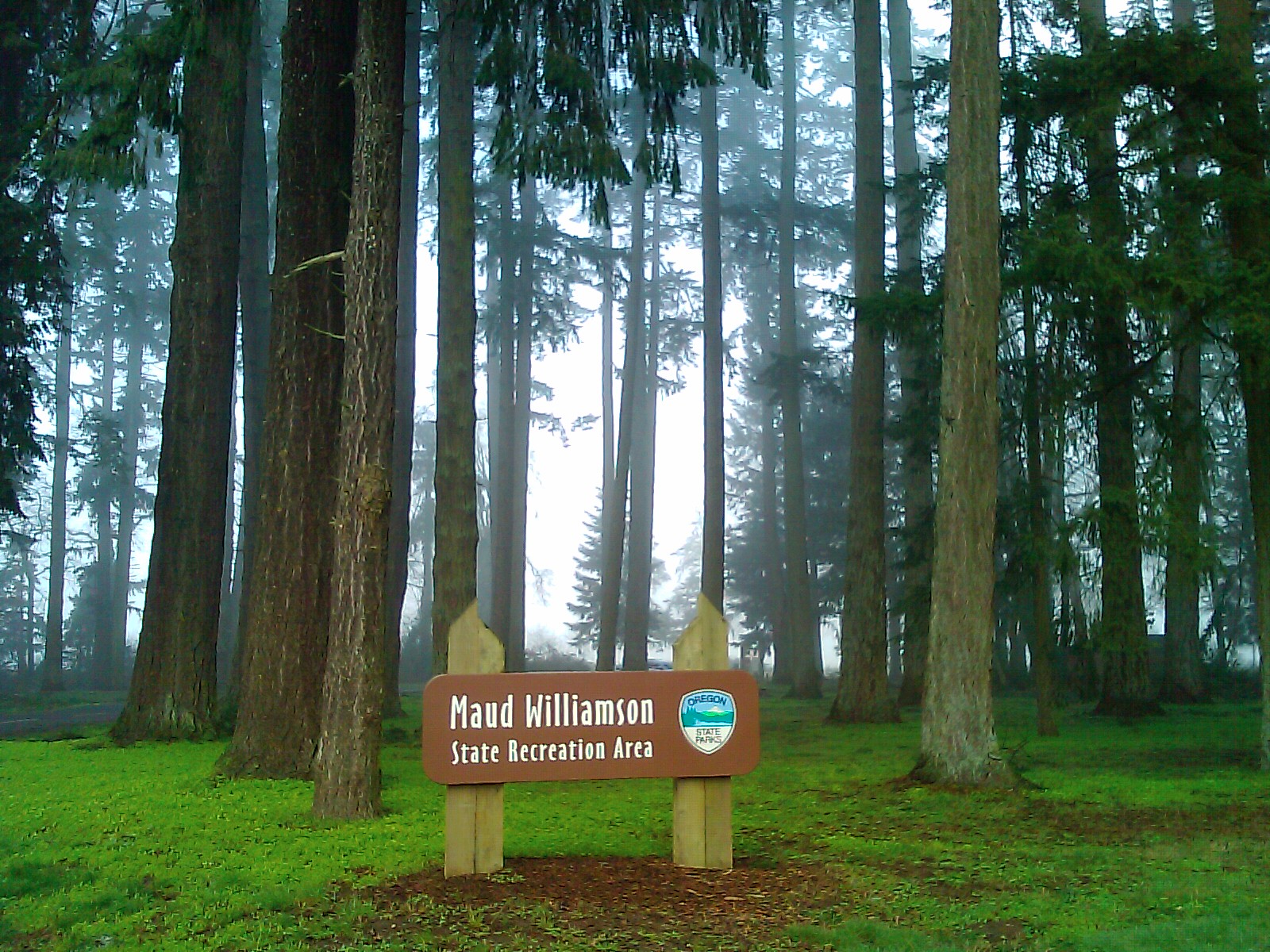
My riding partner Mark called and asked about the weather. He lives in the West Salem Hills and looking down toward the Willamette River, he could see fog. His concern was that there would be fog on his ride to our starting point, Maude Williamson State Park.
"No fog here" I said, but then looked out my back door which faces the river. "Well, perhaps some, but it does not look bad." Even with the hint of fog, he decided to ride his Masi, another bike that does not come out in the rain.
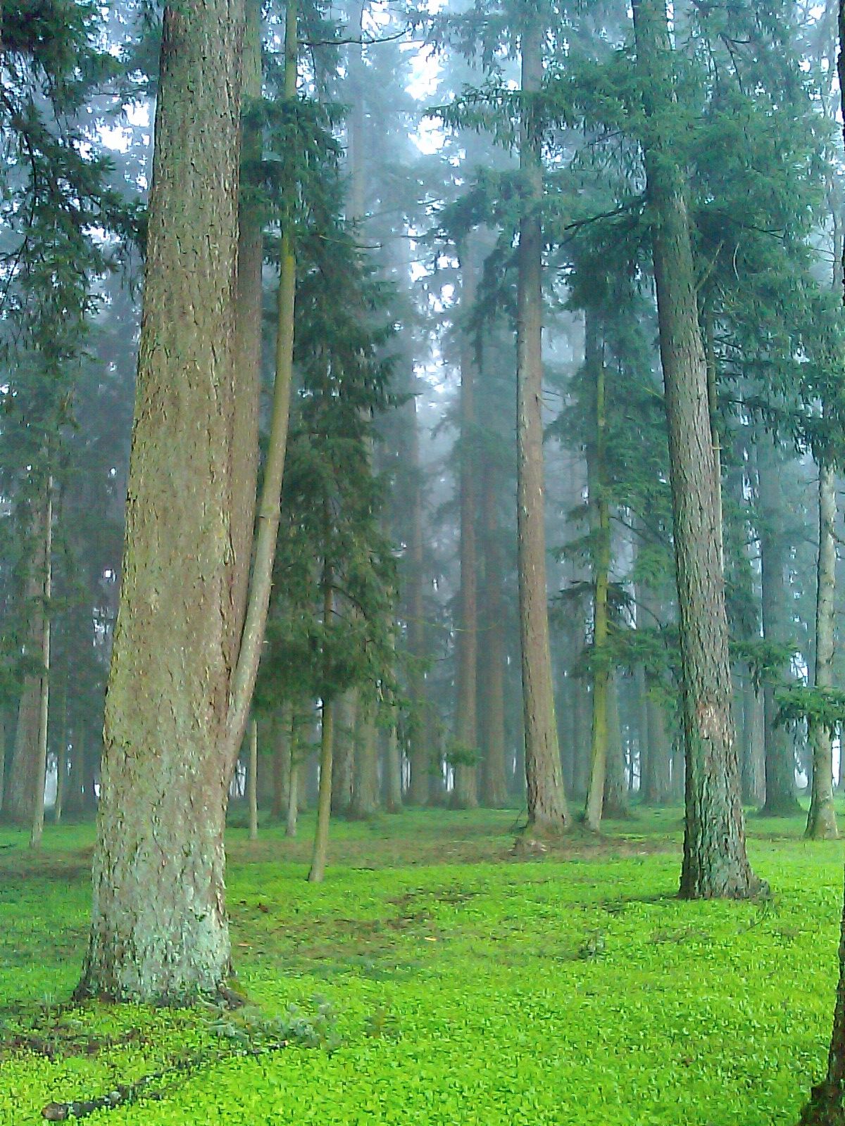
Leaving home, I found that the fog had closed in and I wondered about the wisdom of my decision to remove my taillight (some times it falls off of the seat bag).
Crossing the river on the Wheatland Ferry, visibility was very limited. But I knew, believed, or hoped that we would climb about the fog. I was a few minutes late arriving that the park, but mark came a few minutes after me. I was watching for him by looking down the road into the fog.
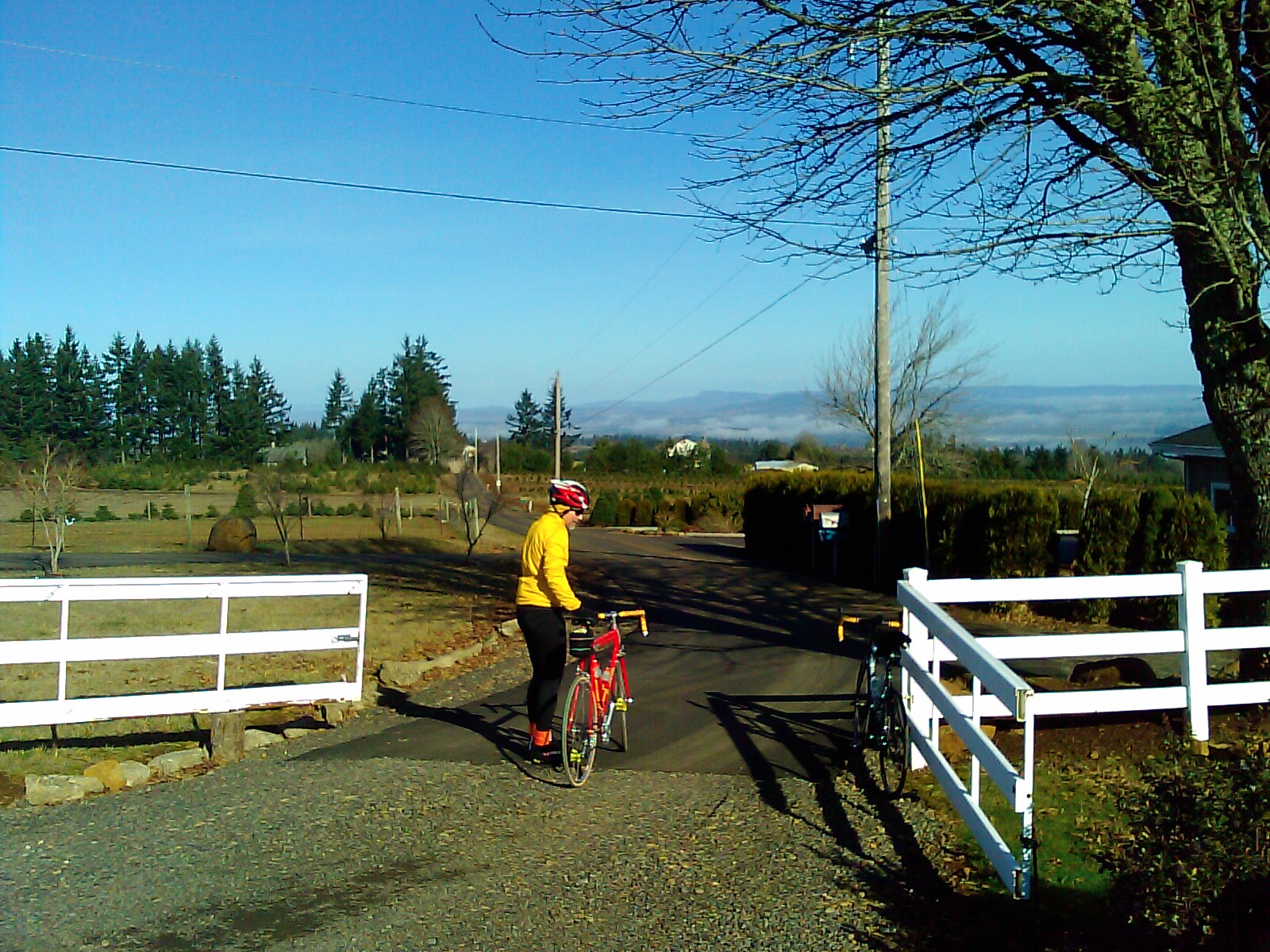
Soon, I saw a ghostly figure came riding toward me. But I was not even sure of what I was seeing. Was this a mailbox or Mark? Slowly, Mark on his red Masi emerged from the fog.
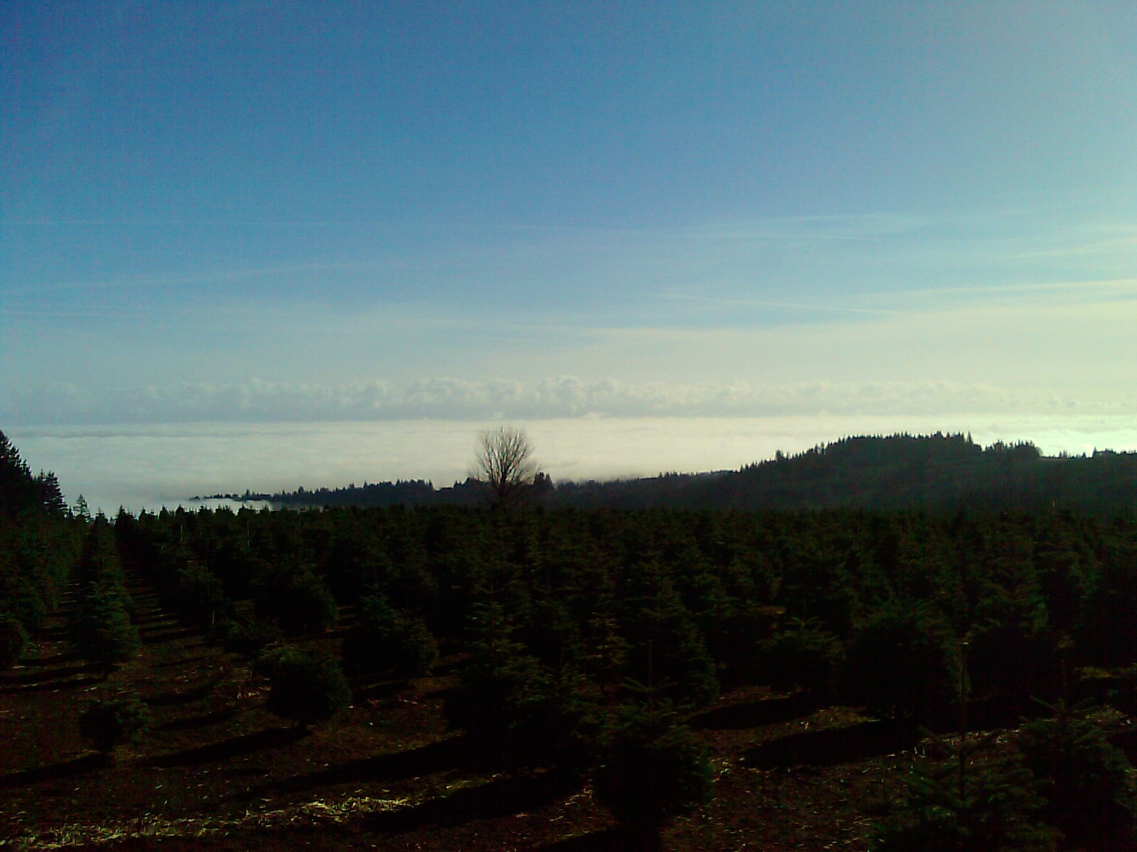
Our first climb was Eloa Hills Road. This is a steep and constant climb for the first mile with some stair stepping at the top. We soon climbed out of the fog and into warm sunlight. We continued up a newly paved dead end road to the highest point we would reach. To the east, we saw a sunlit valley below, to the each, we saw a fogged in valley.
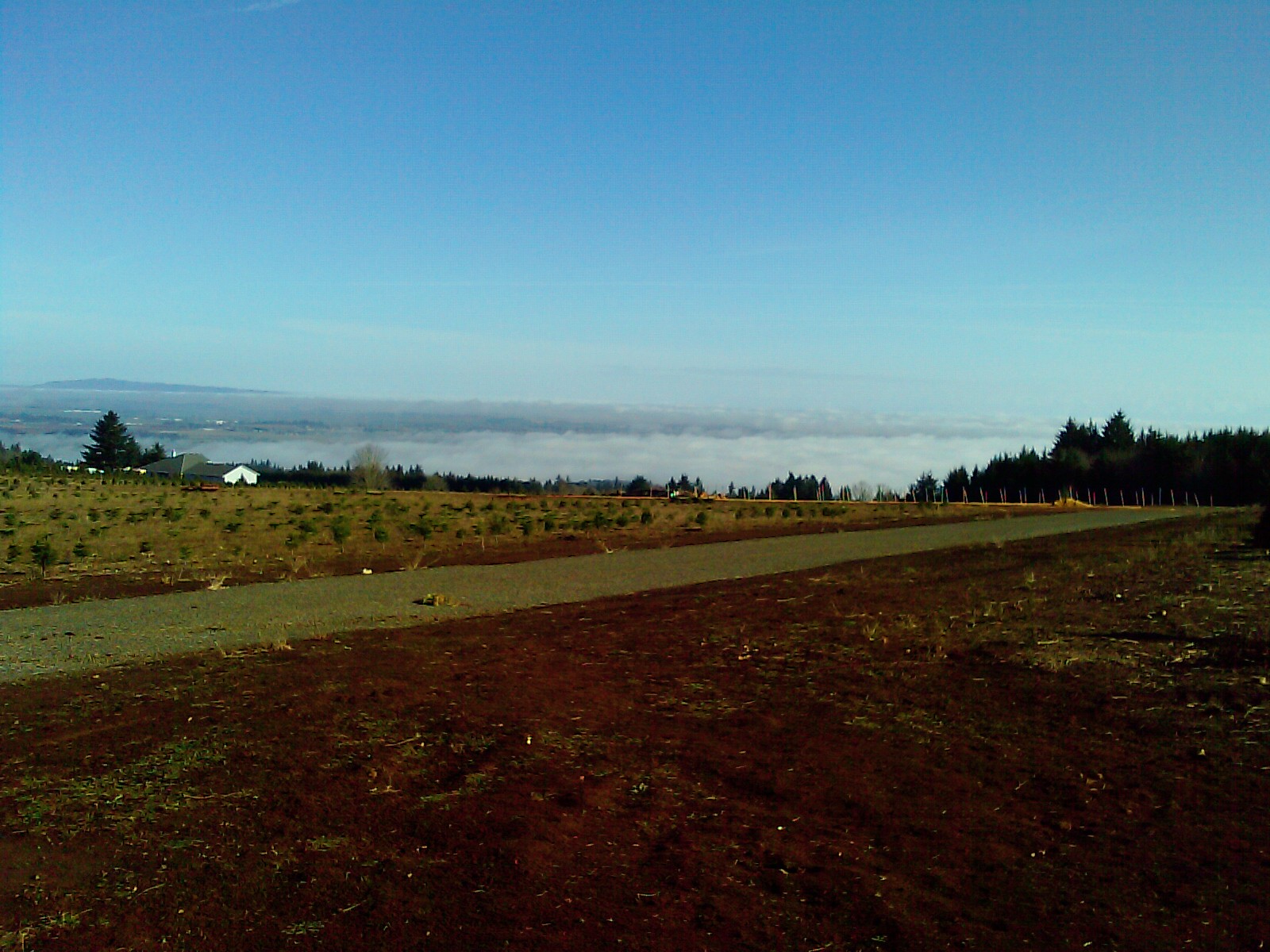
The descent was cool, but never cold as we were riding down into the sunlit valley toward the small town of Amity. However, at the base of the ridge, we turned back toward the east to climb Amity Highway westward. This would be our easiest climb of the day. We descended back toward the fog which was now lifting. Reaching Lafayette Highway, we turned toward the north for 1/2 mile before turning back toward the west and Walnut Hill. This stairsteps up the ridge and has some very steep, but short portions. At the top, we could see the large, green buildings of the Evergreen Air Museum in MacMinnville. The descent was tricky due to the large amount of gravel on the roadway, a result of the recent snowstorm. Now, we had several miles of flat as we road toward Amity.
We stopped at the deli in Amity for food. I choose a large slice of pizzia and Mark got his desired burrito and pasta salad.
Our next climb is toward the northeast of Amity and is one I have never done before - Rice Lane. The first mile is flat along side of the ridge, but then it turns northward and raised steeply. I was soon in my lowest gear (26 x 25), and lifting my front wheel with each pedal stroke. The incline is constant; there is no relief until you reached the top. I could not keep my heart rate down and watched it climb up toward 160 bpm. We gained 550 feet for an average of 12-14% for 2 1/2 miles. A very worthy climb!
The descent was very fast and twisty, I was on my brakes the entire way.
The last climb of the day was a reverse of the first, Eloa Hills eastwards. This one hurt. While I could keep my heart rate down, I could not keep my legs from screaming. I thought to myself, "This is the sound of muscles building." But this did not comfort me. Luckily, this climb was not constant, and there are several sections where I could rest my legs. Obtaining the top, we headed back down the hill we climb this morning, reaching the bottom in a very short period of time.
Mark and I rode back toward Salem together, until we parted ways at Hopewell.
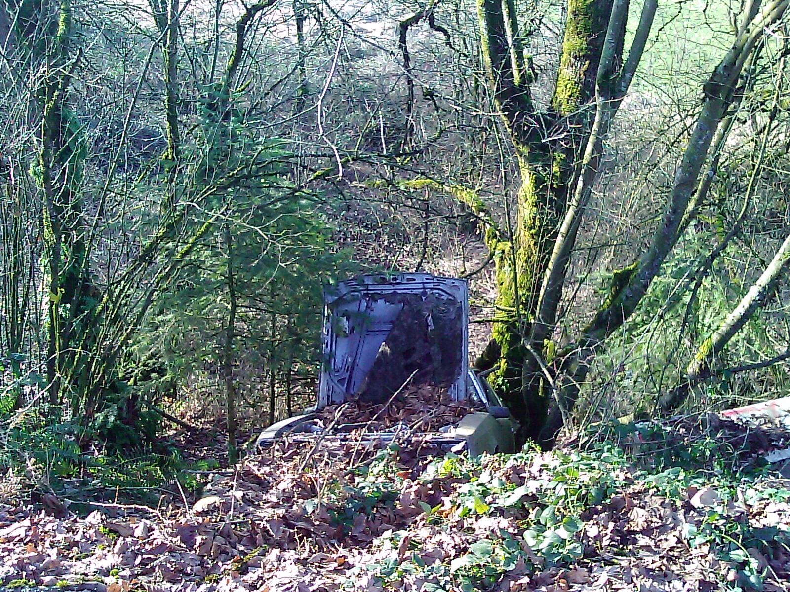
As I approached the Wheatland Ferry, the road descends to the shelf next to the river. Along the bank to the left, for year there has been an orange VW bug in brush. It is only visible in winter, when you can see through the brush. But today I saw that it was gone.
However, near the intersection of River and Brooklake Roads, I saw that someone has deposited a car, almost hidden in the brush. How many years will this one remain?
I must say it was a magnificent day to ride! Only, my legs disagree.