I like to ride my bicycle - for long distances. I have earned the California Triple Crown and finished the Furnace Creek 508. My goals include qualifying for RAAM and ...(read the blog to find out).
"The bicycle has a soul. If you are able to love it as it deserves, it will give you emotions you will never forget."
Mario Cipolini
"Nothing compares to the simple pleasure of a bike ride."
John F. Kennedy
"The important decisions in my life I make while out riding my bike."
Former Italian Prime Minister Romano Prodi
"Pain is temporary, quitting lasts forever.” Lance Armstrong
Sunday, April 20, 2008
Cherry of a Ride
This little known ride is a real gem. The 2008 edition was the third year for the ride and Joanne and I have done all three.
After a continental at the local Super 8 motel where we spent the night, we check out and drove the short distance to the start of the ride. After paying our day of ride registration we were on the course at 7:45 am. We head through a quiet downtown The Dalles and then up Lower 8 Mile Road to Emerson Loop Rd. After climbing up to an elevation of 1148 feet, began a steep decent. After we had pick up speed on the Cannondale tandem, I took my eyes off of the road to look at my computer to see how fast we were going. I saw 39 and thought that was about what I expected. Then it came to me. I had set the display of my HAC4 computer to temperature, not current speed. 39° was the temperature, not our current speed!
The route is passes the first rest stop to an out on 8 Mile Road to where it turns to gravel and then back to the same rest stop. As Joanne and I were feeling well, we blew by the rest stop and continued on toward the gravel. This section of the road is genital rollers but it continues to climb. Since it is an out and back, we were able to wave "Hello" to several riders who were coming back as we headed out. After turning around, we picked up speed and were soon passing the riders we had waved hello to. One jumped on our wheel. We were happy to pull him along until he decided he had enough fun and returned to his left behind girlfriend.
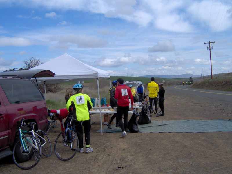
The first rest stop on the 2008 Cherry of a Ride.
After leaving the first rest stop, we descend back to The Dallas via 8 Mile Road. The wind was in our face and as such we just putted along not working too hard. The route took us back through downtown The Dalles where a raised, red Toyota pickup truck tailgated us. The road was two lanes wide, but Big Red was happy to follow us through town at 20 mph. Jealous I guess.
We took the River Front Trail, a multipurpose path along the Columbia River before heading westward Highway 30. This is a gem of a road, lightly trafficked and with great views of the Columbia River Gorge.

Looking westward on Highway 30 outside of The Dalles
There is one thing about Highway 30, it climbs up to Rowena Crest Overlook. The climb is 600 feet in just 3 miles. But once on top, you are rewarded great views of the Gorge.

Looking east from the Rowena Crest Overlook
After leaving the Overlook, we descend into the small town of Mosier where we found the local cafe, the HWY 30 Cafe. Joanne and I must return and spend some time exploring this cafe.
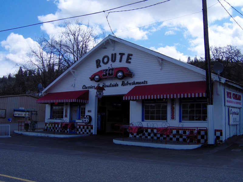
HWY 30 Cafe in Mosier
But, across the street, one can buy a classic International Dump Truck if you have $4,500.
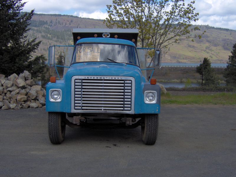
International Dump Truck for Sale in Mosier
We decided to skip the 10 miles through the Mosier Tunnels as we have been there, done that and scattered the tourists before. Instead, we headed up the toughest hill of the day - Dry Creek Road. This rises 1,700 feet in seven miles with several steep sections. During this climb several singles passed us. As they passed, they praised us. Seems climbing hills on a tandem is an achievement to one riding a single. To further there impression, we blew by the water stop on the hill and continued to climb to the top, where we enjoyed a fast, but windy descent.
Reaching the bottom of the hill, we could have turned to the left and returned to The Dallas in four short and flat miles. But no, we turned to the right and headed toward the final climb of the day. By now we were tired and we just limped along, hoping that beyond the next turn we would find the top of the last hill. We had that thought many times as there were many turns that were not the last turn before the final descent. Finally, it came, we descended and the ride was finally over.
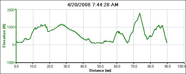
2008 Cherry of a Ride Elevation Graph